Exploring Route 88

Sunset on the Superstitions
After spending a couple days in the northern Phoenix Metro area, Wednesday February 16, we did a day trip from Apache Junction via Highway 88 back to Green Valley. This highway is a very popular scenic route that circles a portion of the Superstition Mountains, northeast of Phoenix.
This highway provides access to Canyon Lake, Apache Lake and Lake Roosevelt on the Wind River and continues to the town of Globe Arizona. I had heard that this was a beautiful drive so we were looking forward to discovering what the attraction.

Superstition Sunset from Apache Junction
We had stayed a couple of nights in Apache Junction, which is a retirement town nestled against the Goldfield Mountains to the north and the Superstition Mountains to the northeast. Both mountains are very impressive and offer wonderful views. Just on the outskirts of Apache Junction, is the ghost town of Goldfield. This has been turned into a tourist attraction but does have a lot of character and interesting mining history. Here is a website with more about it:
http://www.goldfieldghosttown.com/
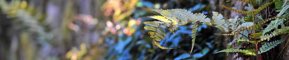
We left Apache Junction mid-morning on Highway 88 and immediately found ourselves in a very beautiful section of the Superstitions. There were many hiking trails along the way, as we climbed to a pass near Apache Gap before descending to Canyon Lake and Tortilla Flats.

Near Apache Gap
Tortilla Flats is a small tourist trap that has an interesting collection of old buildings that have been converted to shops and restaurants. Here is the towns web page that will give you a little history of this historic old town:
http://www.tortillaflataz.com/oldwesttown/history.html

Tortilla Flat

Hang 'Em High!

Old School Building
We hadn’t gone far out of Tortilla Flat before the pavement ended. I checked my map as I thought it was all a paved highway but discovered there was nothing on that indicated that. We climb a predominate ridge and came to a point of interest called Fish Creek. This is an overlook with a paved path and restrooms. It was a nice facility for being out in the middle of nowhere. The view off the ridge path was spectacular. This ridge must have been around 6000 feet elevation or more. Check out the view! 


The road dropped steeply from there and in place was only one lane. Sharp switchbacks and sheer rock walls with nothing but air for several hundred feet on the other side was the norm. Check out the view from a turnout near a bridge: 

After about 30 miles or more of dirt road we finally came to Apache Lake. It wasn’t too far after that we hit pavement again. We climbed the grade around Roosevelt Lake dam and got our first view of Roosevelt Dam. This is a very large reservoir and must be around 20 miles long.

Apache Lake
As it was almost noon we decided to look for lunch in a town on our map called Roosevelt then go see the Tonto Cliff dwellings after that. Again we were misled by the map and there really wasn’t a town. What was there, was a community with a large assortment of camp grounds on the lake. Well so much for lunch. We decided to see the cliff dwelling first and then find food later.

Roosevelt Lake
The Tonto National Monument is only about 2 or 3 mile south of Highway 88 and just west of Roosevelt about a mile. There are two cliff dwelling site here but only one of them is open to the public with a self-guided tour. The other is by reservation and you would need at least two months’ notice for a ranger to take you to the larger site a couple miles up a nearby canyon.

I see it up there!
We parked at the visitor Center then too the steep, paved half mile trail up to the site. The view of the lake and valley from the trail is wonderful. At the site we found a volunteer that was able and ready to tell us all about the history of the site. Like most National monuments, most of the duties are done by volunteers with one ranger to supervise. Here is the web site for this National Monument:
http://www.nps.gov/tont/historyculture/index.htm
We really enjoyed the site and exploring the ruins remaining structures. It’s a very amazing place and considering all the materials except the stone were imported. Those early people most have been in very good shape to run up and down these steep hills! Here are some pictures of what we saw:

We're almost there.


Want to grind some corn?


Back down the trail.
It was getting late and we did finally find a place to eat at the only restaurant, just across the street from the post office, southeast of Roosevelt lake. From there into Globe, was one huge mine after another. We did do a quick drive through the historic downtown area of Globe which looks like something right out of the 50’s. We also didn’t have time to check out the Besh-Ba-Gowah Archaeological Park, located just outside of the town. http://www.jqjacobs.net/southwest/besh_ba_gowah.html
From there we took highway 60 to the town of Superior and drove right by the Oak Flats recreation area. That looks like a good place to hike if I just had a little time. From Superior, we took Highway 177 and 77, through Mammoth, Oracle and back to Tucson.
This is a very beautiful trip and we could have spent a couple days or more if we really wanted to see it all. I would wholeheartedly recommend this drive to anyone in the area. I’ll definitely find a way to do some hiking in the Superstitions some other time.
I hope you have enjoyed this daytrip and will be thinking of doing a daytrip near you some time soon. Keep looking for the beauty all around you.
Dennis
